Hiking near Kalispell: Jewel Basin – Birch Lake
The Jewel Basin is a hiking mecca in northwestern Montana with 35 miles of hiking trails and over 15,000 acres. It’s easy to see why it’s so popular, based upon the beautiful scenery and many options for hiking trails.
The Jewel Basin is located in Flathead National Forest, about a 30 minute ride from Kalispell. If you head towards Bigfork, pick up MT-83. After a few miles, you’ll turn onto Echo Lake Road. Another 2 miles will take you to Foothill Rd. Take that for about a mile, and turn onto Jewel Basin Road. A mere 7 miles later, you’ll be at the Camp Misery Trailhead, the starting point for many different trail options.
But let’s stop right there. The “mere” 7 miles of Jewel Basin Road needs to be explained in a bit more detail so you’re properly prepared. First, if our experience yesterday is any indicator, you’ll need a 4WD or AWD vehicle. If you have anything loose in the back of your truck, make sure it’s tied down. Because this isn’t a paved highway. It’s an unpaved road, full of washboard hills. And you’re definitely going to be bouncing around a bit.
Also, while on most of the seven miles it would be possible for two vehicles to squeeze by each other, there are a few spots that definitely only fit one car. In addition, those particular areas are on the side of the mountain, with no place to pull off. So you’ll need to go slow in the event you meet another vehicle and one of you will need to backup. If you’re speeding over the gravel road on its washboard surface and need to slam on your brakes, you just might have seen your last mountain vista.
 So once you’ve made it to the trailhead, there are multiple options for hiking. There is a map there, a restroom (outhouse) and a parking lot that can fit about 20 cars. On the gorgeous Sunday we visited the park, there were also cars parked quite a way down the road. It was perfect hiking weather.
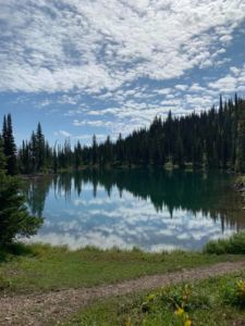
 I can’t speak to all the different hikes, but I can let you know about the Camp Misery trailhead to Birch Lake trail. When leaving the parking area, you’ll take the 717 trail which is located to the right of the ranger house. You’ll follow that about 1.5 miles until you get to an area where three trails branch off. If you take the Alpine 7 trail from there, and hike another 1.5 miles, you’ll reach Birch Lake. The trail map lists this as a moderate hike, as there is a fair amount of uphill and downhills required. There are also some narrow trails on the side of the mountains. But it’s a great hike and is not that difficult. It did take us about 4 hours to do the round trip, which included one detour (see next paragraph).
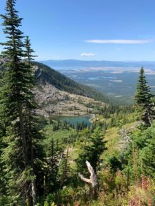
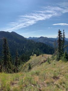
 After we had hiked about a mile from the parking area, there was a narrow trail that went up to the right, up to the top of the mountain. On a clear day, you see the entire quarter mile path while standing at the bottom. Most people walked right by, but we decided to hike up to the top. The detour was definitely worth a little huffing and puffing! We were greeted by an amazing 360 degree view of many rugged mountains, and most of the Flathead Valley. It’s a sight not to be missed.
The entire hike took us from an elevation of 5,760 feet at the parking lot (3,090 feet at the beginning of that 7 mile road!) to 6,427 at the top of the detour trail I mentioned above. It was an amazing day for a hike, as all the photos here show.
I would definitely recommend hiking at the Jewel Basin, and I’m sure we’ll be attempting some of the many miles of trails at another time! The access road was more stressful than the hiking!
Happy trails!